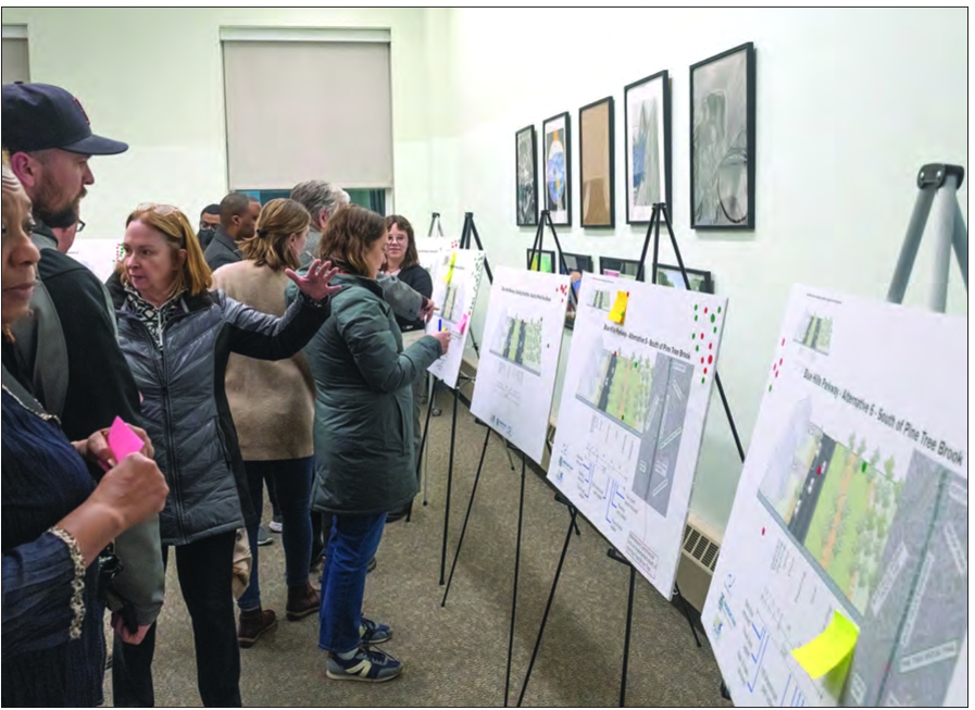
Community members look at proposals for a redesign for Blue Hills Parkway in Milton at a community meeting, Jan. 15. The redesign, which would add new infrastructure for pedestrians and cyclists, aims to connect Boston’s southern neighborhoods to the Blue Hills Reservation.
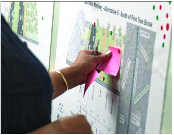
Community members shared feedback on proposals by voting with green and red stickers for the option they favored or opposed.
Just 5 miles south of Mattapan, the Blue Hills Reservation that covers parts of Milton, Quincy, Braintree, Canton, Randolph and Dedham is one of the largest state parks that’s closest to the city of Boston.
Yet, because the 7,000-acre park is only really accessible by car, Boston residents closest to the Blue Hills are often not able to use the resource for the green oasis that it is.
Plans displayed at a community meeting in Milton on Jan. 15 hope to change that. The Metropolitan Area Planning Commission (MAPC), a public regional planning organization; and the Neponset River Watershed Association are undertaking a feasibility study to assess what a more pedestrian- and bike-friendly path to the Blue Hills from southern Boston might look like.
Increasing access for community members along the Neponset River Greenway and along Blue Hill Parkway in Milton “is a huge priority for us and we’ve heard that throughout the community as well,” said Andres Ripley, greenways program director at the Neponset River Watershed Association.
“There’s people who live in the area, they want to get to the reservation, but they don’t have a way of doing that now safely,” he said.
The need for increased connections to the Blue Hills by methods other than cars has been highlighted in plans by groups like MAPC, the Department of Conservation and Recreation’s (DCR) Parkways Master Plan and bike and pedestrian plans in Boston, Milton and Quincy.
A 2023 survey conducted by the team behind the new project found that the majority of those who reported visiting the reservation said they drove to get there.
Not having a way to get there was a major reason for those who said they hadn’t been to the Blue Hills. Of the 930 respondents to the survey — 30% of whom came from the Boston neighborhoods closest to the Blue Hills Reservation — 85% said they’d like to bike to the reservation but that biking the route currently feels unsafe.
The community meeting focused on the part of the project that would bring changes to the stretch of the Blue Hills Parkway in Milton from Mattapan Square to where it becomes Unquity Road. A related effort would explore creating more infrastructure between that point and the Blue Hills Reservation.
That route, which would probably terminate at a recreational area in the reservation known as Houghton’s Pond, would create the most direct access to the Blue Hills, said Marah Holland, a senior transportation planner at MAPC and project manager for the “Boston to Blue Hills” effort.
“We’ve heard, through our community engagement, that folks really want something that’s easy and simple and a really direct connection,” Holland said. “There’s no straighter, more direct connection than Blue Hills Parkway.”
The project team has developed four preliminary designs, which range from switching the locations of existing bike and parking lanes to create a more protected path for cyclists behind parked cars to widening the existing median to add a biking and walking path.
Community members present at the meeting voted with green and red stickers for the option they favored or opposed. Most chose the option with the center-running path.
“I think that design in particular has so much opportunity to create safe, enjoyable, direct routes for folks,” said Holland. “Creating more of a park-like space in front of people’s homes really does allow for a lot of new and more enjoyable activities.”
While there has been fairly wide support for the Blue Hills Parkway project from the neighboring community, some at the meeting expressed concerns about how the proposed changes would impact parking, traffic or driveway access for those who live along the roadway.
Widening the median, for instance, would require eliminating one of the two northbound traffic lanes. But engineers who have been working on the project said that traffic on each of the northbound lanes is well below the ideal lane capacity — a theoretical measure of how many cars can move in a lane given ideal conditions. The ideal is 1,500 cars per hour, but only about 800 cars were recorded on both lanes during a peak weekday morning hour. During the evening peak hour, only about 450 cars were on the road.
The project team also pointed to the fact that traffic calming measures could be implemented to increase safety.
Concerning next steps, the project team will work to dig deeper into one design to focus on in the feasibility study. That study will be presented to DCR, which owns the roadway and would be responsible for implementation. DCR would also be responsible for securing funding for the work, which may push the timeline for construction given unreliable federal funding and tight state and local budgets.
“For this particular project, we know that there’s a lot of funding constraints,” Holland said. “In this political environment and funding environment, I think it’s easier to think about [doing it] piecemeal so that we don’t run into barriers to try to go from zero to 100 right away.”
The Blue Hills Parkway planning comes as part of a broader MAPC effort, called the LandLine initiative, to build out a network of trails connecting Metro Boston communities to the Blue Hills for walking, biking and “rolling” — other types of personal wheeled mobility besides bicycling.
“You can see all the little pieces here,” said David Loutzenheiser, a senior transportation planner at MAPC, “but we’re trying to make it so there are small loops and big loops.” He was hopeful that “the more we build it, the more people will come.”
LEARN MORE
Community members looking for more information about the project or looking to provide feedback to the project team can visit mapc.org/resource-library/boston-2-blue-hills
